您好,登錄后才能下訂單哦!
您好,登錄后才能下訂單哦!
這期內容當中小編將會給大家帶來有關如何進行地圖GPS軌跡錄制,文章內容豐富且以專業的角度為大家分析和敘述,閱讀完這篇文章希望大家可以有所收獲。
在地圖的使用中,尤其在導航場景下,進行GPS軌跡錄制是十分必要并且有用的

對于一個GPSRecordSystem(GPS軌跡錄制系統)主要分成3個部分:開始錄制,錄制GPS定位,結束錄制并存儲,如上圖右方所示。在實際應用中,以導航系統為例:(1)在開始導航時(start navi),進行錄制工作的相關配置;(2)收到安卓系統的onLocationChanged的callback進行GPSLocation的記錄;(3)結束導航(stop navi)時,停止記錄并存入文件。
用到的相關變量
	private LocationManager mLocationManager;   // 系統locationManager
	private LocationListener mLocationListener; // 系統locationListener

	private boolean mIsRecording = false;       // 是否正在錄制

	private List<String> mGpsList;              // 記錄gps的list
	private String mRecordFileName;             // gps文件名稱
開始錄制
開始錄制一般是在整個系統工作之初,比如在導航場景下,當“開始導航”時,可以開始進行“startRecordLocation” 的配置
	public void startRecordLocation(Context context, String fileName) {
		// 已經在錄制中不進行錄制
		if (mIsRecording) {
			return;
		}
		Toast.makeText(context, "start record location...", Toast.LENGTH_SHORT).show();

		// 初始化locationManager和locationListener
		mLocationManager = (LocationManager) context.getSystemService(Context.LOCATION_SERVICE);
		mLocationListener = new MyLocationListener();
		try {
			// 添加listener
			mLocationManager.requestLocationUpdates(LocationManager.GPS_PROVIDER, 0, 0, mLocationListener);
		} catch (SecurityException e) {
			Toast.makeText(context, "start record location error!!!", Toast.LENGTH_SHORT).show();
            Log.e(TAG, "startRecordLocation Exception", e);
			e.printStackTrace();
		}

// 記錄文件名稱,筆者這里使用“realLocationRecord + routeID”形式進行記錄
		mRecordFileName = fileName;
		if (!mRecordFileName.endsWith(".gps")) {
			mRecordFileName += ".gps";
		}

		mIsRecording = true;
	}
錄制中記錄軌跡 記錄location一般是在獲取安卓系統onLocationChanged回調時調用“recordGPSLocation”
	public void recordGPSLocation(Location location) {
		if (mIsRecording && location != null) {
		// 記錄location to list
			mGpsList.add(locationToString(location));
		}
	}
locationToString工具方法
驅動導航工作的GPS軌跡點一般要包含以下幾個要素,經度,緯度,精度,角度,速度,時間,海拔高度,所以在此記錄下,為后期軌跡回放做準備。
	private String locationToString(Location location) {
		StringBuilder sb = new StringBuilder();

		long time = System.currentTimeMillis();
		String timeStr = gpsDataFormatter.format(new Date(time));

		sb.append(location.getLatitude());
		sb.append(",");
		sb.append(location.getLongitude());
		sb.append(",");
		sb.append(location.getAccuracy());
		sb.append(",");
		sb.append(location.getBearing());
		sb.append(",");
		sb.append(location.getSpeed());
		sb.append(",");
		sb.append(timeStr);
		sb.append(",");
		sb.append(df.format((double) time / 1000.0));
		// sb.append(df.format(System.currentTimeMillis()/1000.0));
		// sb.append(df.format(location.getTime()/1000.0));
		sb.append(",");
		sb.append(location.getAltitude());
		sb.append("\n");
		return sb.toString();
	}
結束錄制并保存gps文件
結束錄制一般作用在整個系統的結尾,例如在導航場景下,“結束導航”時停止錄制調用“stopRecordLocation”
	public void stopRecordLocation(Context context) {
        Toast.makeText(context, "stop record location, save to file...", Toast.LENGTH_SHORT).show();

        // 移除listener
		mLocationManager.removeUpdates(mLocationListener);
		String storagePath = StorageUtil.getStoragePath(context); // 存儲的路徑
		String filePath = storagePath + mRecordFileName;

		saveGPS(filePath);
		mIsRecording = false;
	}
GPS軌跡存儲工具方法
	private void saveGPS(String path) {
		OutputStreamWriter writer = null;
		try {
			File outFile = new File(path);
			File parent = outFile.getParentFile();
			if (parent != null && !parent.exists()) {
				parent.mkdirs();
			}
			OutputStream out = new FileOutputStream(outFile);
			writer = new OutputStreamWriter(out);
			for (String line : mGpsList) {
				writer.write(line);
			}
		} catch (Exception e) {
			Log.e(TAG, "saveGPS Exception", e);
			e.printStackTrace();
		} finally {
			if (writer != null) {
				try {
					writer.flush();
				} catch (IOException e) {
					e.printStackTrace();
					Log.e(TAG, "Failed to flush output stream", e);
				}
				try {
					writer.close();
				} catch (IOException e) {
					e.printStackTrace();
					Log.e(TAG, "Failed to close output stream", e);
				}
			}
		}
	}
StorageUtil的getStoragePath工具方法
// 存儲在跟路徑下/TencentMapSDK/navigation
    private static final String NAVIGATION_PATH = "/tencentmapsdk/navigation";

// getStoragePath工具方法
    public static String getStoragePath(Context context) {
        if (context == null) {
            return null;
        }
        String strFolder;
        boolean hasSdcard;
        try {
            hasSdcard = Environment.getExternalStorageState().equals(Environment.MEDIA_MOUNTED);
        } catch (Exception e) {
            Log.e(TAG, "getStoragePath Exception", e);
            e.printStackTrace();
            hasSdcard = false;
        }
        if (!hasSdcard) {
            strFolder = context.getFilesDir().getPath() + NAVIGATION_PATH;
            File file = new File(strFolder);
            if (!file.exists()) {
                file.mkdirs();
            }
        } else {
            strFolder = Environment.getExternalStorageDirectory().getPath() + NAVIGATION_PATH;
            File file = new File(strFolder);
            if (!file.exists()) { // 目錄不存在,創建目錄
                if (!file.mkdirs()) {
                    strFolder = context.getFilesDir().getPath() + NAVIGATION_PATH;
                    file = new File(strFolder);
                    if (!file.exists()) {
                        file.mkdirs();
                    }
                }
            } else { // 目錄存在,創建文件測試是否有權限
                try {
                    String newFile = strFolder + "/.test";
                    File tmpFile = new File(newFile);
                    if (tmpFile.createNewFile()) {
                        tmpFile.delete();
                    }
                } catch (IOException e) {
                    e.printStackTrace();
                    Log.e(TAG, "getStoragePath Exception", e);
                    strFolder = context.getFilesDir().getPath() + NAVIGATION_PATH;
                    file = new File(strFolder);
                    if (!file.exists()) {
                        file.mkdirs();
                    }
                }
            }
        }
        return strFolder;
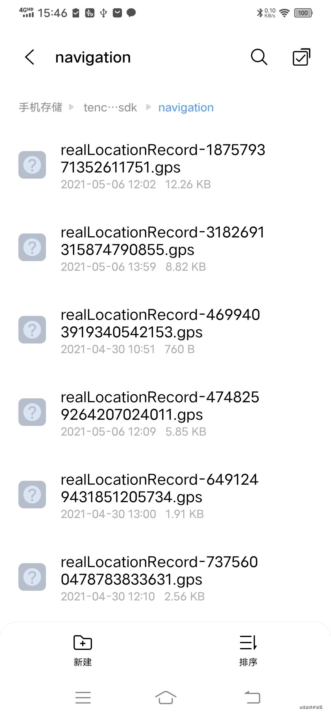
}最終存儲在了手機目錄下的navigation目錄

可以對于錄制的gps文件講解在導航場景下進行軌跡回放的分享
上述就是小編為大家分享的如何進行地圖GPS軌跡錄制了,如果剛好有類似的疑惑,不妨參照上述分析進行理解。如果想知道更多相關知識,歡迎關注億速云行業資訊頻道。
免責聲明:本站發布的內容(圖片、視頻和文字)以原創、轉載和分享為主,文章觀點不代表本網站立場,如果涉及侵權請聯系站長郵箱:is@yisu.com進行舉報,并提供相關證據,一經查實,將立刻刪除涉嫌侵權內容。